Aerial Drone
Thermal Imaging
Contact Us For a Free Consultation
We will get back to you as soon as possible.
Please try again later.
Hover Visions Inspection Services
Oil & Gas, Utility and Infrastructure entities can benefit from the use of current and up-to-date aerial photography data with camera sensors such as thermal imaging, multispectral, high-resolution RGB and optical zoom inspection cameras.
Drone inspection makes it possible to access areas that may pose health, safety and environmental risks in a fast and safe way.
- inspection of areas difficult to access
- Find additional potential damage
- access to areas that pose health, safety and environmental risk to humans
- quick on-site deployment of the drone
- authorised and qualified UAV-inspection personnel
- reduced downtime
Hover Visions Drone Thermal Imaging
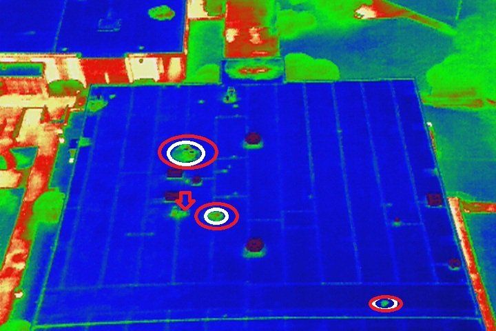
Hover Visions is proud to offer thermal imaging solutions to its list of products offered to our clients. The images shown above are actual images taken and processed by Hover Visions; not copied off the internet and used to promote our service in hopes of getting business. The image to the far left is a thermal scan of a public water storage tank in west Tulsa. The center image is a thermal imaging scan at an electrical substation which shows a possible insulator issue. The right side image is a thermal scan of an oil storage tank facility showing tank levels. This is a project performed for trading market investors.
FAA Licensed Private Pilot with over 600 hours of logged flight time in single and multi-engine aircraft as well as helicopter flight time. Over 200 hours of logged flight time with UAV's (drones) that includes experience not only with multi-rotor UAV but also fixed wing UAV. I have provided services to many large commercial investment firms, construction companies as well as working with a Hollywood film company. I have experience with HD and UHD cinematography as you will see on our website. I have vast experience using UAV's for agriculture, land and construction surveys and producing high-quality orthomosaic and digital surface maps and models, 3D renderings and crop health analysis data. License #: 16632


